Results 1 to 14 of 14
Thread: Rendering mountains
-
2019-08-23, 02:39 PM (ISO 8601)Troll in the Playground


- Join Date
- Mar 2014
 Rendering mountains
I've been working on a map for my campaign, and I began using a pen to ink in the geographical forms. I typically avoid pen and go for pencil, but I thought the visual clarity and permanence would be good in this instance. However, I am running into something of an issue when attempting to draw the mountains. Currently, I have them drawn in pencil in my usual manner: soft, irregular curving lines that vaguely imitates the shading done by more professional maps without my needing to do the same sort of detailed analysis of every slope and ridge that informs those practices. Since ink doesn't allow for quite the same controlled variation in softness and lightness that graphite does, I do not believe I will be able to replicate this using pens. Simple outlines of the mountains look too much like the same outlines I've done for lakes, and I don't want to do the Tolkienesque iconic representation of drawing a number of wedges in a chain.
Does anyone have any suggestions for how to render mountains with pen? What sort of techniques do you use?
-
2019-08-23, 03:00 PM (ISO 8601)Banned

- Join Date
- May 2012
- Location
- Kansas City
Re: Rendering mountains
 Originally Posted by VoxRationis


-
2019-08-23, 03:57 PM (ISO 8601)Orc in the Playground

- Join Date
- May 2010
Re: Rendering mountains
GG, Gg!

-
2019-08-23, 10:03 PM (ISO 8601)Troll in the Playground
- Join Date
- Mar 2014
Re: Rendering mountains
Thank you very much. That's an excellent demonstration.
-
2019-08-23, 10:08 PM (ISO 8601)Barbarian in the Playground

- Join Date
- Aug 2017
Re: Rendering mountains
Use different pens. You art store has hundred of different one; shape, width, color, etc.
-
2019-08-24, 07:18 AM (ISO 8601)Ogre in the Playground

- Join Date
- Dec 2018
- Location
- Space Australia
- Gender

Re: Rendering mountains
... And saved.
Thank you Gallowglass
-
2019-08-24, 03:05 PM (ISO 8601)Bugbear in the Playground

- Join Date
- Mar 2004
Re: Rendering mountains
This is kinda amazing. I've drawn mountains before for D&D maps... and I feel like I've spent too long trying to make them look like mountains... but this seems... much easier.
Need a character origin written? Enjoyed what I wrote? How can you help me? Not required, but appreciated! <3
Check out my 5e The Secret of Havenfall Manor or my character back stories over at DMsGuild.com! (If you check it out - please rate, comment, and tell others!)
Subscribe to my D&D Channel on Youtube! (Come by and Sub)
-
2019-09-02, 10:06 AM (ISO 8601)Ogre in the Playground
- Join Date
- Apr 2011
- Location
- 30.2672° N, 97.7431° W
- Gender
Re: Rendering mountains
I guess it really depends on the level of detail that you are willing to put into your maps. If your willing to put in the time, you could end up with something like this:
 "Sleeping late might not be a virtue, but it sure aint no vice. The old saw about the early bird and the worm just goes to show that the worm should have stayed in bed."
- L. Long
I think, therefore I get really, really annoyed at people who won't.
"A plucky band of renegade short-order cooks fighting the Empire with the power of cheap, delicious food and a side order of whup-ass."
-
2019-09-03, 11:15 AM (ISO 8601)Banned
- Join Date
- May 2012
- Location
- Kansas City
Re: Rendering mountains
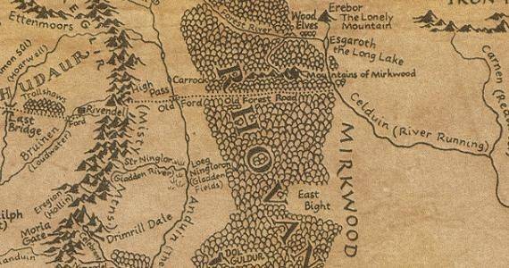
"OP post specifically says doesn't want to draw wedges in a chain like a Tolkien map"
"Poster replies with picture of wedges in a chain on an actual Tolkien Map."
Ah, forum.... don't ever change.
-
2019-09-03, 12:12 PM (ISO 8601)Ogre in the Playground
- Join Date
- Apr 2011
- Location
- 30.2672° N, 97.7431° W
- Gender
Re: Rendering mountains
Poster makes a comment about the level of detail the OP may or may not wish to dedicate to map making and provides example of detailed map (witch happens to be a Tolkien map as they are the most common found on the internet). Originally Posted by Gallowglass
Man on high horse makes judgmental comment.
Ah, forum...blah blah blah."Sleeping late might not be a virtue, but it sure aint no vice. The old saw about the early bird and the worm just goes to show that the worm should have stayed in bed."
- L. Long
I think, therefore I get really, really annoyed at people who won't.
"A plucky band of renegade short-order cooks fighting the Empire with the power of cheap, delicious food and a side order of whup-ass."
-
2019-09-08, 12:32 AM (ISO 8601)Firbolg in the Playground


- Join Date
- Feb 2016
Re: Rendering mountains
Originally Posted by Gallowglass
I've gotts say, Gallowglass' example actually looks more detailed despite also looking much easier to draw Originally Posted by Mutazoia
"If you want to understand biology don't think about vibrant throbbing gels and oozes, think about information technology" -Richard Dawkins
Omegaupdate Forum
WoTC Forums Archive + Indexing Projext
PostImage, a free and sensible alternative to Photobucket
Temple+ Modding Project for Atari's Temple of Elemental Evil
Morrus' RPG Forum (EN World v2)
-
2019-09-08, 11:09 AM (ISO 8601)Ogre in the Playground
- Join Date
- Apr 2011
- Location
- 30.2672° N, 97.7431° W
- Gender
Re: Rendering mountains
Drawing the style 2 or 3 mountains is just as much work as doing the style 1, even with out shading, once you factor in drawing in all of the satellite ridges. Originally Posted by Bohandas
No matter what style you use, it all eventually boils down to how much time and to what level of detail you want to invest in your maps."Sleeping late might not be a virtue, but it sure aint no vice. The old saw about the early bird and the worm just goes to show that the worm should have stayed in bed."
- L. Long
I think, therefore I get really, really annoyed at people who won't.
"A plucky band of renegade short-order cooks fighting the Empire with the power of cheap, delicious food and a side order of whup-ass."
-
2019-09-10, 04:33 PM (ISO 8601)Troll in the Playground
- Join Date
- Jan 2006
- Location
- Protecting my Horde (yes, I mean that kind)
Re: Rendering mountains
It also depends on what you want the map to do. A big black line labeled "Mountains of Epic Death!" along the path you want them to move is just as good as any other method, because it conveys that there are mountains of epic death there. If you happen to want a highly detailed contour map so that you can use to travel from A to B in the real world, the big black line isn't so helpful. Originally Posted by Mutazoia
Any way, I guess what I'm try to say is maps are based on intended use. The London Tube map is neither to scale, or accurate represents distances between stations accurately. However, it is a really good map for telling commuters what stations are on what lines, and in what order they are on the line. Anything more than flow chart design is more an art piece rather than useful map. Not that the art piece doesn't have value, but you have to ask yourself how are you using this, which help tell you what you want to do.
All that being said, the mountain option outlined by GG is a good one for a nice top down kind of view.Last edited by Beleriphon; 2019-09-10 at 04:34 PM.
-
2019-09-10, 08:51 PM (ISO 8601)Titan in the Playground
- Join Date
- Oct 2010
- Location
- Dallas, TX
- Gender
Re: Rendering mountains
Steal from the best:
Spoiler: Middle-Earth

 Reply With Quote


 RSS Feeds: